River Nore Linear Park
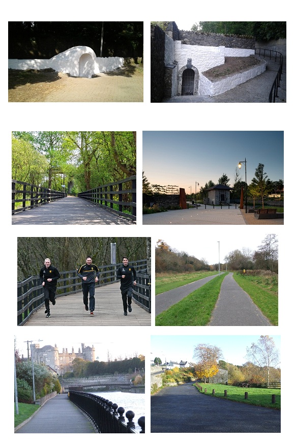
The River Nore Linear Park is a network of walks on both banks of the River Nore through Kilkenny City. The Park provides an attractive pedestrian and mostly cyclist friendly option to explore the River and its heritage, taking a break from the hustle and bustle of city life.
The Canal Walk
During the late 1750s efforts were afoot to make the River Nore navigable between Kilkenny and Inistioge. By 1761 there was more than 4 miles of canal cut from Kilkenny towards Inistioge and a fine stone bridge, 300 feet in length, had been constructed at Inistioge. Ultimately the project to make the Nore navigable between Kilkenny and Inistioge did not materialise. The positive outcome from all of this is that the people of Kilkenny were left with their much loved and far famed Canal Walk.
The Canal Walk is located between Kilkenny Castle and Park and the River Nore. Rising on high ground above the Walk is Kilkenny Castle and Park dating back to 1192 when it was built by the Normans. There are a number of access points to the Castle Park along the Canal Walk.
The Canal Walk is a very attractive walk, very popular with locals and lined for much of its length with mature trees. Various mill races, mill buildings, weirs, wells and remnants of the old canal all provide interest points along the walk.
The walk loops back to Kilkenny city centre via the Lacken Walk on the eastern river bank. To complete the loop, cross the River via the Ossory Pedestrian Bridge, an attractive timber based pedestrian bridge, which spans the river approximately 1.8km from this point and proceed upstream back towards the City Centre.
Alternatively, walkers may continue along the Nore Valley Walk, proceeding downstream after crossing the Ossory Pedestrian Bridge. Way marking signs will guide those unfamiliar with the route.
Bishops Meadows Walk
Substantially refurbished in 2009, the Bishops Meadows Walk derives its name from the riverside meadows. The horseshoe weir near the start of the walk was provided as part of the Kilkenny City Flood Relief Scheme (2002) and represents the start of the Flood Relief Scheme for the City, the flood relief scheme works extending a further 5km downstream from this point.
Beyond the meadows, the Walk extends to the picturesque Talbot's Inch Village and the site of the old Talbot's Inch Pedestrian Bridge. Talbot's Inch Village was built by Lady Desart in the early 1900s on the western side of the River Nore and the pedestrian bridge, also built by Lady Desart in 1906, provided the link to the mills on the eastern bank of the River. The bridge was destroyed in the great flood of 1947 but remnants of the Bridge are still visible. At the end of the Bishopsmeadows Walk is the Bleach Road Weir which supported the local mill industries.
Lacken Walk
The Lacken Walk is a combination of the old and the new. The Ossory Pedestrian Bridge, constructed in 2014, provides a direct link between the Lacken Walk and the Canal Walk. Additionally, the Lacken Walk boardwalk, constructed in 2011 and substantially renovated in 2024, provides year-round access over wet and flooded ground linking to the concrete pathway constructed in the 1950s.
Key points of interest along the Lacken Walk include the Lacken Well and the Lacken Mill. The Lacken Well is a covered well built into the hillside and includes a plaque dated 1831 at which time the well was altered and improved. The Lacken Mill is a ten-bay four storey corn/flour mill which was built in 1774 and disused since 1946. The site of the Lacken Mill has had associations with milling for centuries.
When walking along the Lacken Walk please take the time to visit the Viewing Area on the Dublin Road which offers spectacular views of the River Nore and Lacken Weir with Kilkenny Castle as the backdrop.
Continuing through the grounds of County Hall, the flood embankment provides spectacular views of the River and Castle. County Hall is the site of the school at which Jonathon Swift was educated and, it is at this point where the Lacken Walk brings you back to John's Bridge in the centre of Kilkenny City.
Peace Park
The Peace Park is located on the east side of the River Nore, linking Greensbridge Street and John’s Quay.
The 600m linear walk includes the Kilkenny World War 1 Memorial. Unveiled in 2018 by the collaboration and community involvement between Kilkenny County Council and The Kilkenny Great War Memorial Committee, this memorial commemorates over 800 men and women from the County of Kilkenny who died in World War 1 (1914-1918). Engraved in tablets of Kilkenny Limestone on a natural stone wall looking out on the famous landmarks of Kilkenny City are the names of those who fought for the rights of small nations like ours. In the centre of the memorial stands a Soldier in repose, paying respect to his dead colleagues.
Abbey Quarter Riverside Gardens
The Riverside Garden is a walkway through the Abbey Quarter site that links The Tea Houses at Bateman Quay to Greens Bridge. The gardens were officially opened to the public in June 2021.
The gardens consist of areas of high quality hard and soft landscaping, and is the first project to link the former Smithwicks Brewery site into the public realm of the city.
The Riverside Garden incorporates the long-awaited skate park for the city. The skate park is located in the area between St Francis Bridge and the River Breagagh and was developed in conjunction with the Kilkenny Recreation & Sports Partnership.
The planting species in the park were selected for their pollinator friendly and riverside characteristics to attract insects and other wildlife.


 Kilkenny County Council
